Featuredpodcast
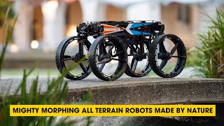
In this episode, we discuss the fascinating world of bioinspired robotics. Discover how researchers have created versatile robots inspired by nature's flight, rolling, and walking abilities.
In this episode, we discuss the fascinating world of bioinspired robotics. Discover how researchers have created versatile robots inspired by nature's flight, rolling, and walking abilities.
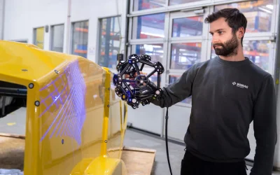
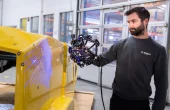
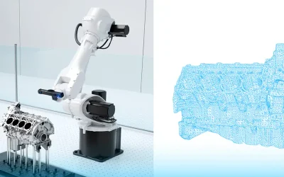
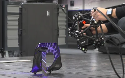
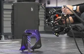
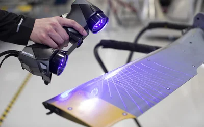
BOMAG’s team was searching for 3D measurement solutions to add to its portfolio that would enable uncomplicated, flexible and non-contact measurement of free-form surfaces, such as castings and plastic parts. The ideal 3D measurement solution also needed to be portable so that scanning of large components and the highest quality standards could be guaranteed.
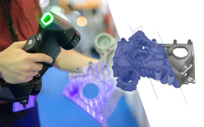
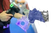
This blog aims to illustrate the different manufacturing challenges leading to product defects and highlight how 3D scanning technology allows for more features and parts to be inspected. It also describes how QC managers can shorten inspection time and reduce production costs associated with scraps.
Design engineers, hardware integrators, and automotive technicians frequently need to verify whether relays are healthy or need replacement. This article provides a thorough, step-by-step approach to testing relays while explaining the underlying science and standards.
9 minutes read.
12 minutes read.
11 minutes read.

Robotics and Drones
We empower R&D by providing the computational power, ROS packages, payloads...
14 Posts

Drone Fleet Management Software
Cloud Ground Control is a cloud based command and control solution for oper...
7 Posts
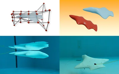
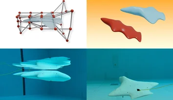
An AI pipeline developed by CSAIL researchers enables unique hydrodynamic designs for bodyboard-sized vehicles that glide underwater and could help scientists gather marine data.
A spherical prototype with "nimble dimples" can change its surface from smooth to dimpled, cutting through drag and generating lift.
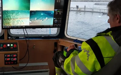
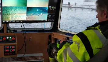
Helping Maintain Stable Position in Fast-Moving Waters
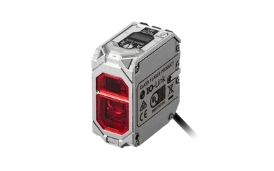
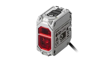
Conventional photoelectric sensors used for object detection and distance measurement can struggle with dark, glossy, or irregular targets because they rely on light intensity. Time-of-flight laser sensors overcome these challenges by using distance-based sensing instead.
Why traditional inspection can no longer keep pace with modern automotive production, and what to do about it
Physics Behind the Blue Laser Advantage
Learn how Shining3D is driving precision in automotive and civil aviation.
In this episode, we discuss the fascinating world of bioinspired robotics. Discover how researchers have created versatile robots inspired by nature's flight, rolling, and walking abilities.

17 minutes read
BOMAG’s team was searching for 3D measurement solutions to add to its portfolio that would enable uncomplicated, flexible and non-contact measurement of free-form surfaces, such as castings and plastic parts. The ideal 3D measurement solution also needed to be portable so that scanning of large components and the highest quality standards could be guaranteed.

2 minutes read
This blog aims to illustrate the different manufacturing challenges leading to product defects and highlight how 3D scanning technology allows for more features and parts to be inspected. It also describes how QC managers can shorten inspection time and reduce production costs associated with scraps.
5 minutes read
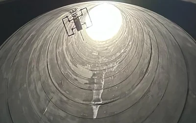
First NON-entry confines space Ultrasonic Thickness inspection with an aerial robot.

3 minutes read
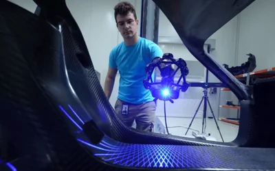
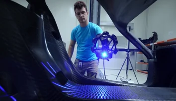
Endurance racing does not only require the best and latest technology. It also involves having the ability to harness it for multiple hours in a row without causing disaster. When you are competing at the highest level and against the best of the best, attention to detail is everything. This means leaving no stone unturned, no issue unresolved. Only then can a racing team truly be at the top of its game.
3 minutes read
3D scanning can be used to measure objects of art in order to assess their 3D dimensions accurately.
3 minutes read
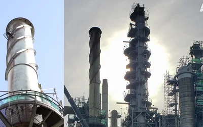
The inspection of stack interiors presents challenges due to limited access and poor visibility. Avestec overcame these obstacles by employing the remote capabilities of their aerial robot.
As IoT evolves, projects are shifting from being experimental and exploratory to business critical. This makes them more complex, ensures they receive more scrutiny and, inevitably, increases the opportunities for things to go wrong. This is even more true when you consider that IoT devices and solutions have a long shelf life, making long-term success only possible if you’re properly planning and building today for the unknown factors in the future.

3 minutes read
First article inspection (FAI) is a crucial step in the manufacturing process. The quality control (QC) team needs to optimize this phase of inspection in order to limit the back and forth between conception and fabrication. The QC team must not only correctly identify the defects, but also provide relevant data, measurements, and results for solving the identified problems.
6 minutes read
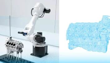
The main—if not the sole—purpose of reverse engineering is to gain knowledge about the design and development steps shrouded in the guise of a finished product. But what is backwards engineering if not a means to address practical issues such as machine downtime, part replacement, and maintenance or repair challenges?
6 minutes read
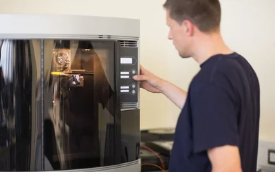
In this article, we look at the importance of using a 3D printer air filter to remove potentially harmful fumes from the print environment, as well as the different kinds of filter available and how to ensure proper maintenance.
Intelligent flying robots emerged as an alternative to overcome the challenges of stacks inspections
3 minutes read
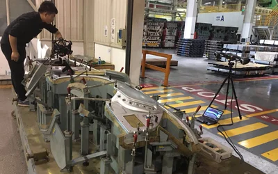
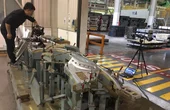
Leading global transport solutions provider reduces its inspection times with the Creaform 3D scanner
3 minutes read
Flying robots have emerged as an innovative solution for conducting ship inspections.
3 minutes read
Space startup Astrobotic mimics the moon's surface material and tests various designs of new moon rovers.