Featuredpodcast
In this episode, we delve into the remarkable achievement of the German Aerospace Center (DLR) as they successfully execute the maiden flight of their hybrid demonstrator aircraft.

This white paper explains how precision timing solutions support reliable PNT architectures across aerospace, defense, and industrial systems.
In this episode, we delve into the remarkable achievement of the German Aerospace Center (DLR) as they successfully execute the maiden flight of their hybrid demonstrator aircraft.
In early 2023, a joint survey from the Royal Aeronautical Society and Protolabs was conducted to learn more about the aerospace sector’s most important concerns and top priorities. Tim Robinson FRAeS examines the results, and provides you with a breakdown.
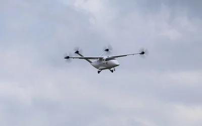
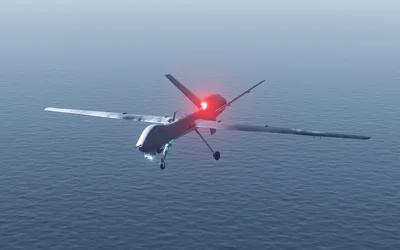
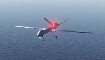
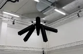
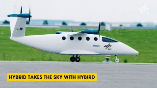
HyBird is a small, hybrid-electric aircraft concept. Its goal is to serve routes of less than 1000 kilometres and with low passenger volumes in a climate-compatible way. The German Aerospace Center (DLR) has now successfully conducted the first flight of a 1:4 scale demonstrator of HyBird at the National Experimental Test Center for Unmanned Aircraft Systems in Cochstedt.
Unveiling the Duel of Digital Design - A Comprehensive Exploration of History, Syntax, and Applications of the two popular hardware description languages
16 minutes read.

Aerospace
Airspeeder is the world’s first racing series for electric flying cars. Our mission will accelerate eVTOL (electric vertical tak...
26 Posts

Robotics and Drones
We empower R&D by providing the computational power, ROS packages, payloads...
14 Posts

Drone Fleet Management Software
Cloud Ground Control is a cloud based command and control solution for oper...
7 Posts

Automation Machinery Manufacturing
Addcomposites is the provider of the Automated Fiber Placement (AFP) ecosys...
5 Posts
Learn why growing hardware teams slow down as they scale, and how aligned workflows, parallel collaboration, and real-time design visibility restore speed and momentum.
How standardized electronic identification will enable high-volume, complex drone operations.
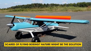
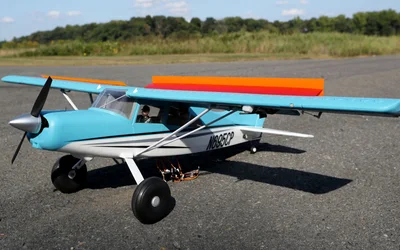
In this episode, we explore how the mechanics of bird wings are inspiring new approaches to prevent airplanes from stalling and learn how bio-mimetic designs from nature are paving the way for innovations in aviation, enhancing stability and safety for future flights.
Taking inspiration from bird feathers, Princeton engineers have found that adding rows of flaps to a remote-controlled aircraft’s wings improves flight performance and helps prevent stalling, a condition that can jeopardize a plane’s ability to stay aloft.
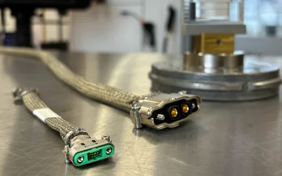
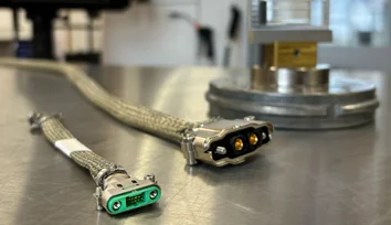
How does connector design influence UAV performance in demanding environments? Harwin explores high-reliability connectors for next-generation UAVs.
An interview with Ryan Smart, VP of Product at Harwin, discussing the challenges of shielding in high-reliability connectors, high-current design trends, and the hybrid power-and-signal connector layouts.
Adding Intelligence to Radar with the BrainChip Real-Time Micro-Doppler Classification
CBC Interview: InDro Robotics CEO Philip Reece on the New Federal Budget & Technology
In this episode, we delve into the remarkable achievement of the German Aerospace Center (DLR) as they successfully execute the maiden flight of their hybrid demonstrator aircraft.

16 minutes read
In early 2023, a joint survey from the Royal Aeronautical Society and Protolabs was conducted to learn more about the aerospace sector’s most important concerns and top priorities. Tim Robinson FRAeS examines the results, and provides you with a breakdown.

5 minutes read
HyBird is a small, hybrid-electric aircraft concept. Its goal is to serve routes of less than 1000 kilometres and with low passenger volumes in a climate-compatible way. The German Aerospace Center (DLR) has now successfully conducted the first flight of a 1:4 scale demonstrator of HyBird at the National Experimental Test Center for Unmanned Aircraft Systems in Cochstedt.

3 minutes read
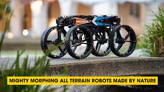
In this episode, we discuss the fascinating world of bioinspired robotics. Discover how researchers have created versatile robots inspired by nature's flight, rolling, and walking abilities.
17 minutes read
In this episode, we discuss the megawatt electric motor design from MIT that aims to address a critical and unspoken shortcoming regarding the future of electric flight: generating enough thrust.
17 minutes read
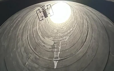
First NON-entry confines space Ultrasonic Thickness inspection with an aerial robot.

3 minutes read
The inspection of stack interiors presents challenges due to limited access and poor visibility. Avestec overcame these obstacles by employing the remote capabilities of their aerial robot.
Intelligent flying robots emerged as an alternative to overcome the challenges of stacks inspections
3 minutes read
In today’s world, continuous connectivity sounds like an everyday given. But delivering it is far from simple.

2 minutes read
ISTAR flights focus on the flight-mechanical and flight-dynamic characteristics of the modified Dassault Falcon 2000LX. Novel sensors measure how the aircraft behaves during specific flight manoeuvres.
4 minutes read
Flying robots have emerged as an innovative solution for conducting ship inspections.
3 minutes read
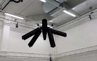
Elythor, an EPFL spin-off, has developed a new drone whose wing shape can adapt to wind conditions and flight position in real time, reducing the drone’s energy consumption. What’s more, the position of the wings can change, allowing the drone to fly vertically or horizontally. These features make it a perfect candidate for inspecting power plants.

4 minutes read
In this article, we will dive deep into the world of simultaneous localization and mapping using Lidar technology. Lidar SLAM has been gaining popularity in recent years, thanks to its versatility and applications across various domains, including autonomous vehicles, mobile robotics, and indoor mapping.
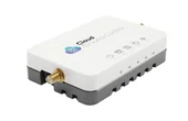
CGConnect, its cellular micro-modem that uses 4G/5G networks to link any drone or robotic vehicle to Cloud Ground Control’s cloud-based drone fleet management platform, enabling live-streaming, command and control from a web browser.

2 minutes read
As evidence mounts that gas drilling and sewer systems leak far more greenhouse gases than previously believed, a team of Princeton researchers has developed a method to pinpoint leaks both big and small for speedy repair.