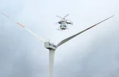

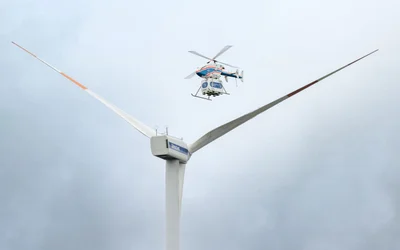
Logistics for offshore wind farms could be simplified with the use of drones. DLR is working with energy supplier EnBW to determine requirements and possibilities.

5 minutes read
Tagged with
Robotics and Drones
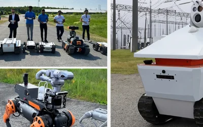
We empower R&D by providing the computational power, ROS packages, payloads & functionality for your unique use case.
14 Posts

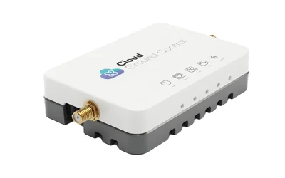
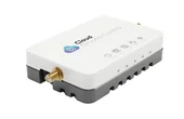
Drone Fleet Management Software
Cloud Ground Control is a cloud based command and control solution for oper...
7 Posts
Logistics for offshore wind farms could be simplified with the use of drones. DLR is working with energy supplier EnBW to determine requirements and possibilities.
5 minutes read
Watch How Flying Robots Like SKYRON Are Redefining Safety Checks at Sea

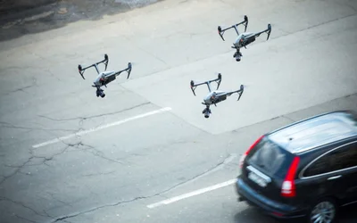
Critical to utilising uncrewed vehicles for disaster relief is the ability to coordinate vehicles into autonomous fleets and leverage live video links for real-time observation.
Drones, coupled with cutting-edge navigation systems, are promising unmatched efficiency and foresight across diverse sectors.
SKYRON's Cutting-Edge Solution Overcomes Hazardous Obstacles and Delivers Rapid Results
BVLOS, swarm, and military-grade encryption will enable wider and more diverse applications of drones, while cutting-edge software platforms enable operators to improve fleet coordination with more data control
Unveiling the Duel of Digital Design - A Comprehensive Exploration of History, Syntax, and Applications of the two popular hardware description languages
In this episode, we discuss the fascinating world of bioinspired robotics. Discover how researchers have created versatile robots inspired by nature's flight, rolling, and walking abilities.

17 minutes read
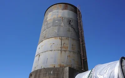
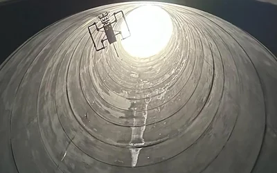
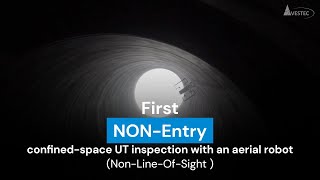
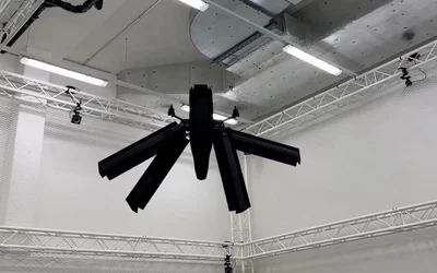
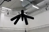
First NON-entry confines space Ultrasonic Thickness inspection with an aerial robot.
3 minutes read
The inspection of stack interiors presents challenges due to limited access and poor visibility. Avestec overcame these obstacles by employing the remote capabilities of their aerial robot.
Intelligent flying robots emerged as an alternative to overcome the challenges of stacks inspections
3 minutes read
Flying robots have emerged as an innovative solution for conducting ship inspections.
3 minutes read
Elythor, an EPFL spin-off, has developed a new drone whose wing shape can adapt to wind conditions and flight position in real time, reducing the drone’s energy consumption. What’s more, the position of the wings can change, allowing the drone to fly vertically or horizontally. These features make it a perfect candidate for inspecting power plants.

4 minutes read
In this article, we will dive deep into the world of simultaneous localization and mapping using Lidar technology. Lidar SLAM has been gaining popularity in recent years, thanks to its versatility and applications across various domains, including autonomous vehicles, mobile robotics, and indoor mapping.
CGConnect, its cellular micro-modem that uses 4G/5G networks to link any drone or robotic vehicle to Cloud Ground Control’s cloud-based drone fleet management platform, enabling live-streaming, command and control from a web browser.

2 minutes read