Lidar vs. Radar: Comprehensive Comparison and Analysis
Explore the key differences, advantages, and applications of lidar and radar technologies in modern engineering projects.

Last updated on 09 Apr, 2024. 14 minutes read
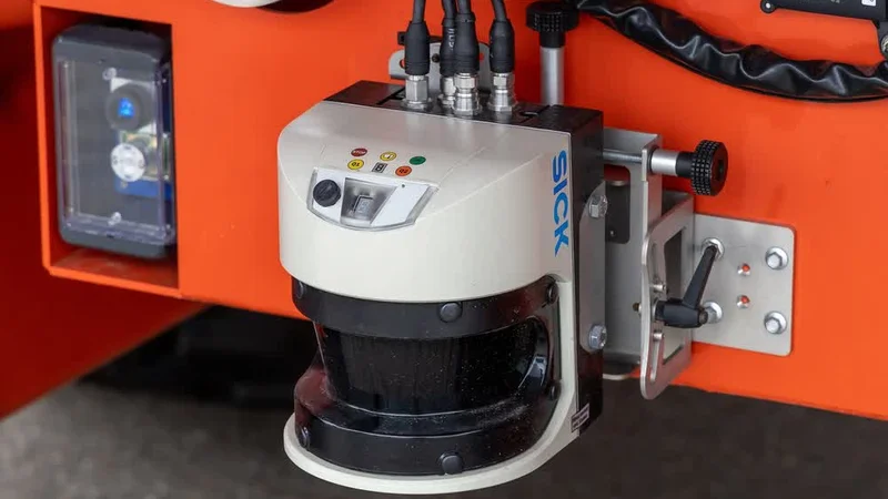
A LiDAR sensor is more compact mountable on a vehicle for driver assistance
Introduction
Lidar and radar are two essential remote sensing technologies that have revolutionized modern engineering applications. Lidar uses laser pulses to measure distances and create 3D maps of objects and environments. Radar, on the other hand, relies on radio waves to detect and track objects, determine their speed, and map terrain.
These technologies have become increasingly relevant in fields such as autonomous vehicles, robotics, and surveying, where they enable precise and efficient data collection and analysis. As lidar and radar continue to advance, they hold immense potential to transform the engineering landscape and drive innovation across various industries.
Understanding Lidar and Radar Technologies
Both Lidar and Radar technologies work on the principle of emitting radiation but in different regions of the electromagnetic spectrum. Each technology deploys different signal processing techniques like waveform analysis, pulse detection, noise reduction, filtering, amplification, and Doppler analysis to precisely measure the object distance from the transmitter.
What is Lidar?
Lidar is short for Light Detection and Ranging. It is an active remote sensing technology that uses laser pulses to measure distances and create 3D representations of objects and environments. Lidar systems typically operate in the near-infrared, visible, or ultraviolet regions of the electromagnetic spectrum, with common wavelengths including
532 nm
905 nm
1550 nm
The technology works by emitting laser pulses and measuring the time it takes for the pulses to reflect off objects and return to the sensor. It calculates the time of flight setting the speed of light as reference, to accurately approximate the distance from the object.
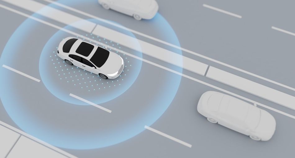 Fig 1: An illustration of an autonomous car using LIDAR to detect obstaclesTypes of Lidar Systems
Lidar systems can be categorized into three main types. The systems are distinguished on their technical characteristics which make them suitable for various applications:
Mechanical Lidar Systems - Use rotating mirrors or scanners to direct the laser beam and cover a wide area.
Solid-state Lidar Systems - Rely on non-mechanical beam steering methods, such as phased arrays or optical switches.
Flash Lidar Systems - Illuminate the entire scene with a single laser pulse and use a 2D detector array to capture the reflected light, enabling faster data acquisition.
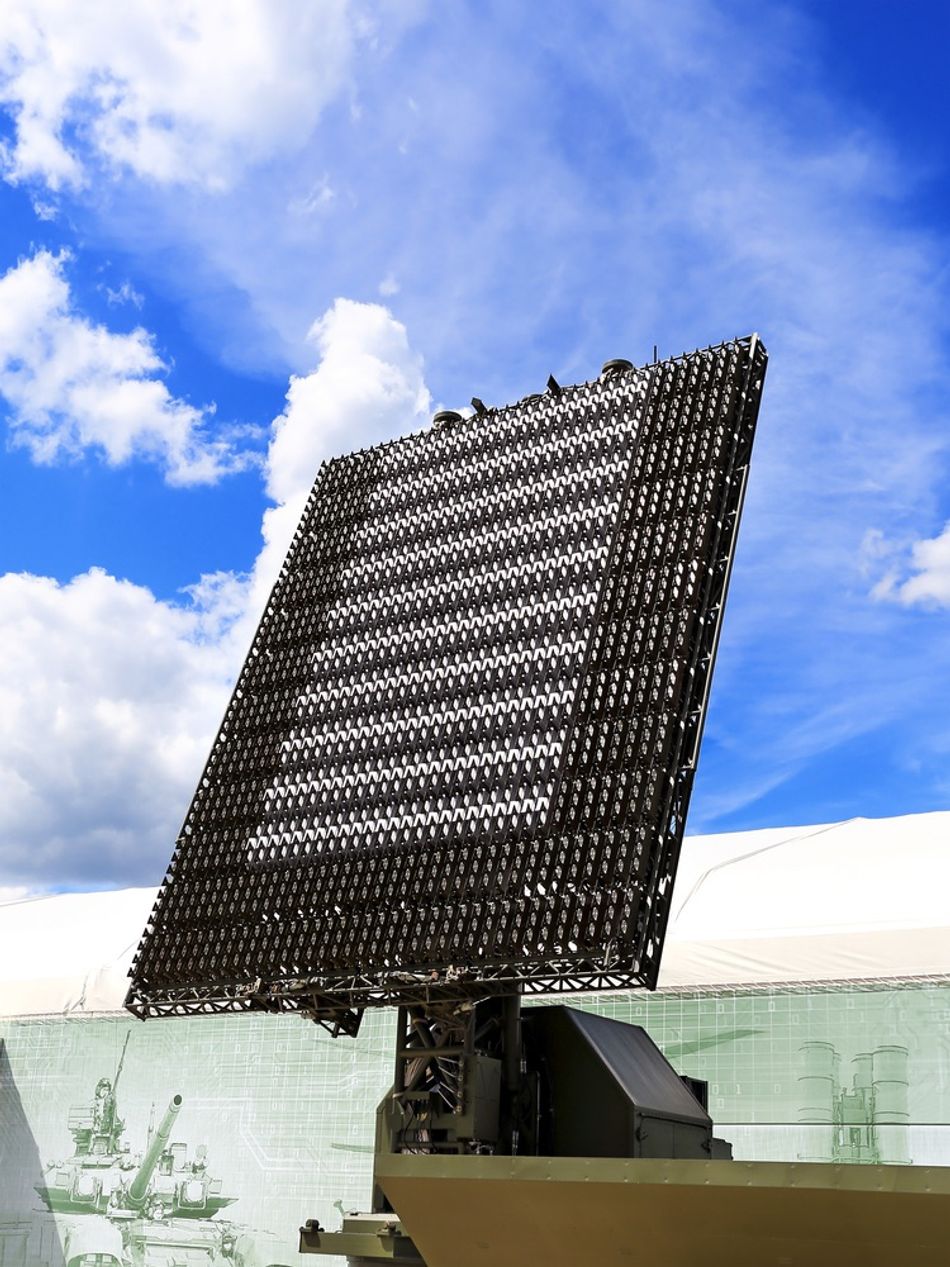
What is Radar?
Radar stands for Radio Detection and Ranging. It is an active remote sensing technology that uses radio waves to detect and track objects. It operates in the radio frequency portion of the electromagnetic spectrum, typically in the microwave range. Common frequency bands used in radar systems include:
L-band (1-2 GHz)
S-band (2-4 GHz)
C-band (4-8 GHz)
X-band (8-12 GHz)
Ku-band (12-18 GHz)
High-frequency radio waves are generated by a transmitter and emitted through an antenna. These radio waves propagate through the atmosphere and reflect off objects in their path. The reflected signals are received by the radar antenna and processed by a receiver. Thanks to their high penetration and range, Radar systems find vast applications in the navigation sector.
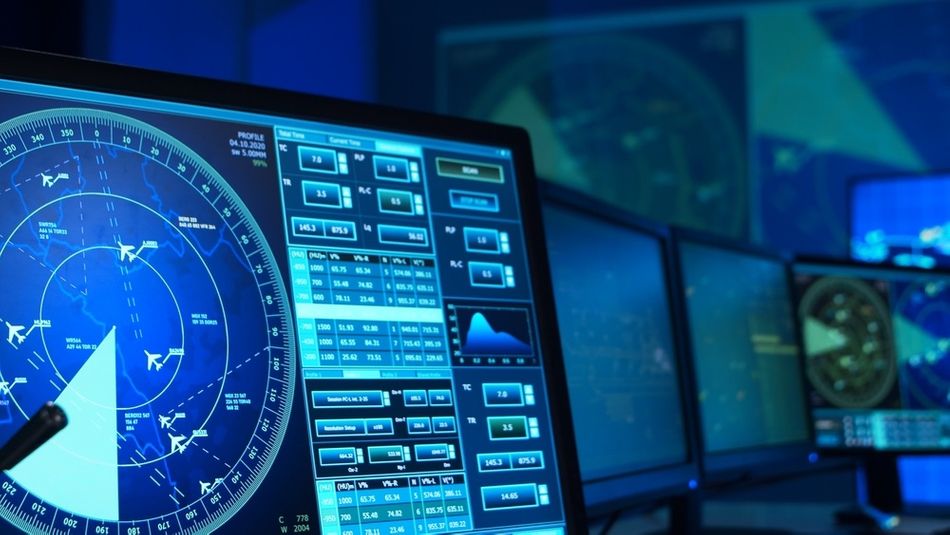 Fig 2: The display of an air-traffic control interfaceTypes of Radar Systems
Radar systems can be classified into several types based on their operating principles and technical characteristics.
Pulsed Radar Systems - Emit short, high-power pulses of radio waves and measure the time delay between transmission and reception to determine the range to the object.
Continuous Wave (CW) Radar Systems - Emit a continuous signal and use the Doppler shift (change in observed wavelength) of the reflected signal to measure the velocity of the object.
Synthetic Aperture Radar (SAR) Systems - utilize the motion of the radar platform to simulate a larger antenna aperture, enabling high-resolution imaging of the Earth's surface. Each type of radar system has its unique capabilities and limitations, making them suitable for various applications in fields such as aviation, meteorology, and remote sensing.
Recommended Reading: RADAR: Full form, working, and applications
Key Differences between Lidar and Radar
While both lidar and radar are active remote sensing technologies, they exhibit several key differences in their operating principles, capabilities, and limitations.
The following table summarizes the key differences between Radar and Lidar.
Characteristic | Lidar | Radar |
Wavelength | Near-infrared, visible, or ultraviolet | Microwave |
Range | Short to medium range | Long range |
Resolution | High spatial resolution | Lower spatial resolution |
Weather sensitivity | Affected by fog, rain, and snow | Less affected by weather conditions |
Data output | 3D point clouds | Range, velocity, and direction information |
Exploring the Differences
Based on the above summary, here are a few critical details to know about the major differences between the two technologies.
Wavelengths
Wavelength and operating frequency are the primary distinctions between Lidar and Radar. Lidar systems operate in the near-infrared, visible, or ultraviolet regions of the electromagnetic spectrum, while radar systems use microwave frequencies. As a result, there is much variation in the range and resolution of the two technologies.
Lidar systems generally have a shorter to medium range but offer high spatial resolution, enabling detailed 3D mapping of objects and environments.
Radar systems have a longer range but lower spatial resolution.
Weather Sensitivity
Lidar signals can be attenuated or scattered by fog, rain, and snow, which can limit their effectiveness in adverse weather conditions.
Since Radar signals operate in the microwave region, they are less affected by weather, making them more suitable for applications that require reliable performance in various meteorological conditions.
Data Processing and Output
Lidar systems generate high-density 3D point clouds, which provide detailed spatial information about the scanned environment. This makes lidar ideal for applications that require precise 3D mapping, such as autonomous vehicles and surveying.
Radar systems don’t have the same spatial detail, but they excel at measuring the range, velocity, and direction of objects. This capability makes radar systems crucial for applications like air traffic control, weather monitoring, and defence.
Advancements in Lidar Technology
Ever since its inception in the 1960s, Lidar technology has greatly evolved as scientists and engineers realized its potential applications in remote sensing, topography, and metrology. Over the years, Lidar technology has improved in resolution, range, and scanning speed. Here are some of the most recent developments in Lidar technology.
Solid-State Lidar Systems
Solid-state Lidar systems replaced traditional mechanical scanning mechanisms with non-mechanical beam steering methods. These systems feature a single laser beam and a time-of-flight (ToF) sensor array to capture 3D data, offering cost- and power efficiency, reduced size and reliability due to minimal moving parts.
However, these systems lack 360° data capture. Advanced versions incorporate MEMS or beam steering for wider scanning, achieving up to 270° horizontal field of view.
Single-Photon Avalanche Diodes
Single-photon avalanche Diodes (SPADs) are highly sensitive detectors that can capture even the weakest reflected signals. They can detect individual photons, so they have revolutionized Lidar technology by enhancing detection range, resolution and speed. , They are suited for high-speed outdoor applications.
For example, long-range lidar systems equipped with SPADs can achieve a range of up to 1 kilometre with centimetre-level accuracy, making them suitable for autonomous vehicle applications. Moreover, advancements in 3D stacking enable smaller pitch, increased pixel count, and more sophisticated processing electronics for SPAD arrays.
MEMS Development
Microelectromechanical systems (MEMS) have enabled the development of compact and cost-effective lidar solutions. MEMS-based solid-state lidar systems integrate miniaturized mechanical components with electronic circuits, resulting in devices with a wide field of view and high frame rates.
A prime example is a MEMS-based lidar with a 120-degree field of view and a frame rate of 30 Hz, which finds applications in robotics and autonomous navigation.
Advances in Radar Technology
Radar technology has witnessed significant advancements in recent years, driven by the development of innovative system architectures, signal processing algorithms, and antenna designs.
Phased Array Antennas
A phased array refers to an electronically scanned array—a system of antennas that can create a focused beam of radio waves without physically moving the antennas. It offers several advantages over traditional mechanically scanned antennas, such as faster scanning rates, enhanced target tracking and multi-target engagement capabilities.
For example, a modern phased array radar system can simultaneously track multiple targets and provide real-time updates on their positions and velocities, enabling effective situational awareness in defense and air traffic control applications.
Digital Beamforming
Digital Beamforming directs radar transmitter and receiver toward a specific direction, with azimuth representing side-to-side and elevation for up-and-down directions, enabling focus in both dimensions. It allows radar signal manipulation in the digital domain, offering:
Improved spatial resolution
Interference suppression
Flexible beam shaping capabilities.
Moreover, applying advanced signal processing algorithms, such as adaptive beamforming and space-time adaptive processing (STAP)helps in dynamic beam pattern adjustment, which optimizes performance in the presence of clutter and interference.
Cognitive Radar Systems
Cognitive radars dynamically optimize performance through real-time feedback and learning, adjusting parameters like frequency, pulse width, and modulation using advanced waveform techniques.
By continuously adapting to the environment, these systems enhance target detection, tracking, and classification in dynamic and cluttered scenarios, demonstrating versatility and effectiveness in changing conditions. Therefore, they can enhance modern applications in drones, autonomous vehicles, and maritime surveillance.
Engineering Applications of Lidar Systems
Lidar technology has found extensive applications across various engineering fields, revolutionizing the way data is collected, analyzed, and utilized for decision-making.
Autonomous Vehicles
One of the most prominent applications of lidar is in the domain of autonomous vehicles. Lidar sensors are integral to the perception systems of self-driving cars, enabling them to detect and map their surroundings with high precision. By generating dense 3D point clouds of the environment, lidar sensors provide crucial information for obstacle detection, road boundary identification, and navigation planning.
Backed by research, companies like Waymo and Cruise have successfully deployed lidar-equipped vehicles in public road testing.
Suggested Reading: Autonomous Vehicle Technology Report
Robotics
Lidar technology has revolutionized the way robots navigate and interact with their environment. Lidar-based simultaneous localization and mapping (SLAM) algorithms allow robots to construct detailed 3D maps of their surroundings while simultaneously determining their own location within those maps.

This capability is essential for autonomous robot navigation, as it enables robots to plan efficient paths, avoid obstacles, and perform complex tasks in unstructured environments. Research has proven the efficacy of lidar-based SLAM as compared to traditional navigation in various robotic systems, from indoor mobile robots to outdoor autonomous drones.
Recommended Reading: Lidar SLAM: The Ultimate Guide to Simultaneous Localization and Mapping
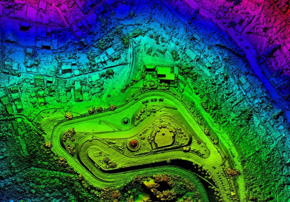
Surveying and 3D Mapping
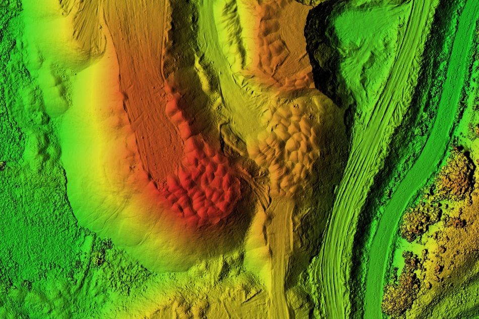
Lidar is now an indispensable tool in surveying and mapping applications, offering high-resolution 3D data acquisition capabilities for topographic mapping, infrastructure monitoring, and geospatial analysis.
High-density lidar point clouds, often acquired using airborne or terrestrial laser scanning systems, provide detailed and accurate representations of the Earth's surface, creating precise digital elevation models (DEMs), 3D city models, and cadastral maps.
Radar Applications in Engineering
Radar technology has found extensive applications in navigation and tracking applications, particularly for long-range scenarios. Here are some of the major applications of radar technology.
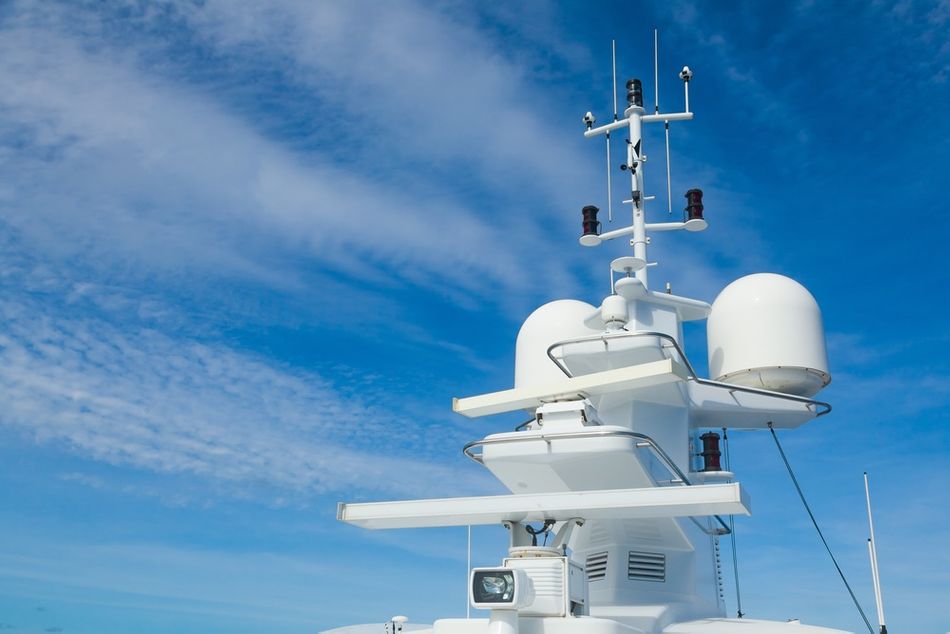
Airspace and Ship Navigation
Radar technology revolutionizes both airspace management and maritime navigation, offering indispensable tools for safe and efficient transportation.
In airspace, radar systems monitor aircraft movements, providing crucial data for air traffic control to ensure safe separation and efficient routing. These systems detect aircraft positions, velocities, and altitudes, enabling controllers to manage airspace congestion and prevent collisions.
Similarly, in ship navigation, radar aids in detecting other vessels, obstacles, and coastline features, enhancing situational awareness and navigation safety. By emitting radio waves and analyzing their reflections, radar enables ships to navigate in adverse weather conditions and low visibility, mitigating collision risks and ensuring safe passage.
Medical Monitoring Devices
As surprising as it may sound, radar sensors have been integrated for a wide range of monitoring applications in the medical sector. These sensors provide a wireless option for detecting vitals such as respiratory rate, and heart rate.
Since these sensors don’t require physical contact, they make it more convenient for patients and healthcare professionals to conduct surveys with no-contact measurements.
Such radars use Frequency-Modulated Continuous Wave (FMCW) sensors to detect subtle human body movements such as chest wall displacement, resulting in a frequency sweep or chirp. The applications promise improved patient safety, accuracy, and scalability for medical practices.
Further Reading: Contactless Measurement of Heart Rate and Respiration Rate: Transforming Healthcare with Radar Sensors
Identification and Tracking of Moving Targets
Radar technology is indispensable for identifying and tracking moving targets across various domains, from military operations to weather monitoring and air traffic control. Radars can accurately determine the location, speed, and trajectory of objects in their vicinity.
This capability is particularly crucial in military applications, where radar is used for surveillance, threat detection, and target tracking. The process of tracking a moving target with radar involves transmitting radio waves towards the target and receiving their reflections.
Advanced radar systems employ sophisticated signal processing algorithms to filter out noise and interference, enabling precise tracking even in challenging environments.
Internet of Things
Radar sensors are increasingly integrated into Internet of Things (IoT) devices, expanding their capabilities and applications. These sensors offer unique advantages such as accuracy, immunity, long-range detection, and immunity to environmental conditions.
In IoT applications, radar sensors are utilized for occupancy detection, object tracking, gesture recognition, and vital sign monitoring.
They enable smart home automation, industrial automation, security systems, and healthcare monitoring. With the ability to operate in various environments and under different lighting conditions, radar sensors enhance the functionality and efficiency of IoT devices, paving the way for innovative and versatile applications in diverse fields.
Recommended Reading: Why Radar Sensors are Powerful Enablers for Intelligent IoT Applications
Limitations of Lidar Technology
While Lidar technology offers several significant advantages and applications, there are a few critical limitations and considerations regarding its use:
Signal Attenuation - Atmospheric particles like dust, smoke, or moisture can attenuate Lidar signals, diminishing system range and signal-to-noise ratio. This limitation affects Lidar's effectiveness in long-range scenarios or adverse weather, necessitating meticulous system design and data processing to counteract its effects.
Lack of Robustness - Due to their sensitivity to environmental conditions, particularly in outdoor environments, Lidar output isn’t always reliable, especially during fog, rain, and snow. Such conditions can scatter and absorb lidar signals, leading to reduced detection range and accuracy, which is critical for applications in autonomous vehicles.
Surface Compatibility - Lidar technology also faces challenges in detecting and measuring certain types of surfaces, particularly non-reflective or highly absorbing. For instance, black asphalt, dark-coloured objects, or water surfaces may not reflect sufficient energy from the laser pulses, making them difficult to detect or measure accurately.
Eye Safety - Eye safety is another important consideration, particularly in systems that employ high-power laser beams. Exposure to intense laser radiation poses risks to human eyes, requiring careful design and implementation of safety measures to ensure compliance with laser safety standards. This may involve the use of eye-safe laser wavelengths, beam-shaping optics, or active safety systems that detect and mitigate potential eye exposure risks.
Cost - The cost of high-performance lidar systems can be a limiting factor in certain engineering applications. Lidar sensors and associated hardware components are more expensive compared to other sensing technologies, such as radar or cameras,
Limitations of Radar Technology
Radar technology, while widely used in various engineering applications, faces several technical challenges and limitations that can impact its performance and reliability.
Cluttered Signals - Signal clutter refers to the presence of unwanted echoes from objects other than the intended targets. It can arise from reflections off the ground, sea, rain, or other environmental factors, creating false alarms and masking the presence of actual targets., significantly degrading performance in air traffic control or maritime surveillance.
Electromagnetic Emissions and Interference - Radar technology is susceptible to interference from other radar sources or electromagnetic emissions operating in the same frequency band. It leads to reduced signal-to-noise ratio and degraded detection performance. Hence, radar systems employ various techniques, such as frequency agility, coding, or interference cancellation algorithms, to improve their resilience and maintain reliable performance.
Resolution Limitations - Radar technology faces challenges in achieving optimal range and angular resolution. Range resolution discerns closely spaced targets in distance, while angular resolution separates targets in angle. Factors like pulse width, antenna aperture size, and signal bandwidth affect these limitations. In applications demanding high-resolution imaging or precise target localization, such as synthetic aperture radar (SAR) or automotive radar, resolution constraints impact data quality. To address this, advanced signal processing techniques like pulse compression or super-resolution algorithms enhance resolution, refining radar system performance.
Doppler Ambiguity - Doppler ambiguity and blind speed limitations are other challenges associated with radar technology. Radar systems rely on the Doppler effect to measure the velocity of moving targets by analyzing the frequency shift of the reflected signal. However, if the Doppler shift exceeds a certain limit, known as the Nyquist frequency, it can lead to ambiguity in velocity measurements and the presence of blind speeds. Blind speeds are specific target velocities at which the radar system cannot accurately determine the true velocity due to Doppler ambiguity. This limitation can impact applications such as traffic monitoring or missile defense, where accurate velocity estimation is crucial.
Conclusion
Lidar and radar technologies have transformed engineering applications, particularly in autonomous vehicles, robotics, surveying, and mapping. Lidar utilizes laser pulses to create precise 3D representations, while radar employs radio waves for object detection and tracking.
Lidar offers high spatial resolution and accurate mapping, ideal for detailed environmental perception and object recognition. However, it's sensitive to atmospheric conditions and has limited range compared to radar, which excels in long-range detection and velocity measurement, suitable for air traffic control and maritime surveillance.
Integrating lidar and radar with AI and machine learning algorithms enhances object recognition and decision-making. Combining their data with other sensors improves environmental perception, benefiting autonomous vehicles, robotics, and smart city applications.
Frequently Asked Questions
What are the main differences between lidar and radar?
Lidar uses laser pulses to measure distances and create 3D maps, while radar uses radio waves to detect and track objects. Lidar offers higher spatial resolution and accuracy, while radar provides a longer range and better performance in adverse weather conditions.
What are some common applications of lidar technology?
Lidar is widely used in autonomous vehicles for obstacle detection and navigation, in robotics for mapping and localization, and in surveying and mapping for creating high-resolution 3D models of terrain and structures.
How does radar technology detect and track objects?
Radar systems emit radio waves and analyze the reflected signals to determine the range, velocity, and direction of objects. By measuring the time delay and Doppler shift of the returned signals, radar can accurately track the position and movement of targets.
What are the limitations of lidar technology?
Lidar is sensitive to atmospheric conditions, such as fog, rain, and snow, which can reduce its effective range and accuracy. Lidar also has limited ability to penetrate through objects and can be affected by surface reflectivity and absorption.
What advancements can we expect in lidar and radar technologies in the future?
Future advancements in lidar and radar will focus on improving resolution, reducing cost and size, and enhancing performance in challenging environments. Integrating lidar and radar with artificial intelligence and sensor fusion techniques will also enable new applications and capabilities in various engineering fields.
References
in this article
1. Introduction2. Understanding Lidar and Radar Technologies 3. Advancements in Lidar Technology4. Advances in Radar Technology5. Engineering Applications of Lidar Systems6. Radar Applications in Engineering7. Limitations of Lidar Technology8. Limitations of Radar Technology9. Conclusion10. Frequently Asked Questions11. References