Sensor Fusion: A Guide to Combining Data for Enhanced Perception and Decision-Making
Learn the powerful approach of combining data from multiple sensors to enhance the overall perception, reliability, and decision-making capabilities of various systems with ease.

Last updated on 28 Oct, 2026. 21 minutes read
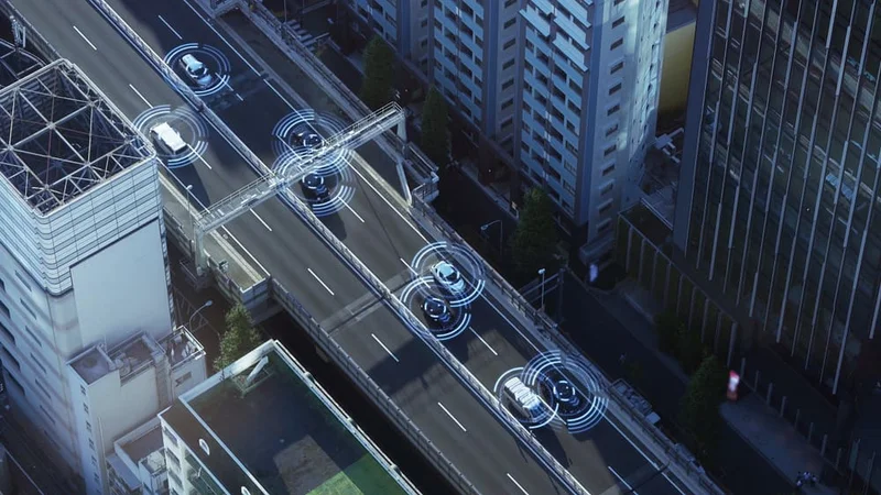
Automotive sensing system concept leveraging sensor fusion technology to aid self-driving cars on the street
What is Sensor Fusion?
Sensor fusion combines data from multiple sensors to create more accurate data to enhance the understanding of the environment than any single sensor could provide.[1]
This process significantly improves the performance of various systems by enhancing their perception and decision-making capabilities, reducing ambiguity and improving overall accuracy.[1]
Thus, sensor fusion plays a critical role in numerous artificial intelligence applications, ranging from robotics and autonomous vehicles to smart cities and the Internet of Things.
In this article, we will explore the importance of sensor fusion, fusion levels, key principles, various techniques and algorithms, challenges, limitations, and real-world applications.
Why Sensor Fusion is Important
Sensor fusion is crucial for several reasons, including enhanced accuracy, robustness, and extended coverage.
These advantages not only improve the performance of various artificial intelligence systems but also contribute to more informed decision-making processes. In the following subsections, we will delve into these benefits in greater detail.
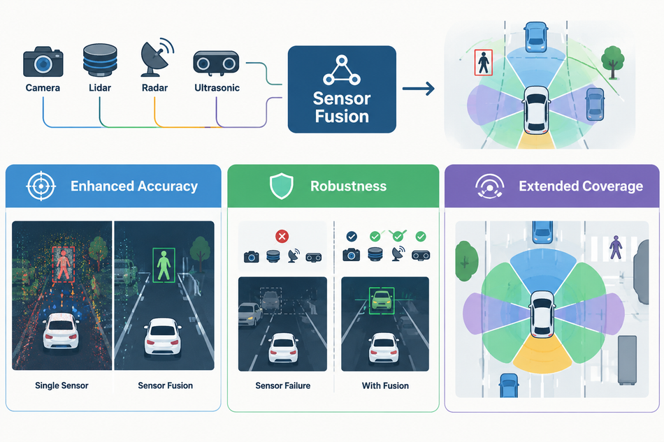
Enhanced Accuracy
Single sensors can produce inaccurate or noisy data for various reasons, such as environmental conditions, manufacturing defects, and device wear and tear.[2]
Sensor fusion addresses these limitations by combining multiple sensors, reducing errors and noise while improving accuracy, decision-making, and system performance.
This enhanced accuracy is especially important in precision- and safety-critical applications such as robotics and autonomous vehicles. In robotics, combining cameras, lidar, and ultrasonic sensors enables reliable perception for navigation, manipulation, and obstacle avoidance, improving decisions, performance, and safety.[3]
Similarly, autonomous vehicles fuse cameras, radar, lidar, and GPS data to detect obstacles, locate vehicles, and navigate complex road networks in real time.[2]
Suggested Reading: Types of Sensors in Robotics
Robustness
As sensor data from multiple sensors is fused together, the system compensates for individual sensor limitations and possible failures. Hence, it enhances system robustness. The use of multiple sensors to measure the same environmental characteristic ensures that useful information remains available when one sensor becomes unreliable.[4]
For example, if one sensor fails to detect an obstacle, other sensors can continue providing relevant information, maintaining environmental awareness. This capability is particularly important in autonomous vehicles, where reliable perception is safety-critical, and vehicles must operate under diverse conditions. Fusing camera, lidar, and radar data can therefore improve fault tolerance, reliability, and robustness compared with relying on individual sensors alone.[4]
Extended Coverage
One sensor has its limitations in terms of range and visibility. Fusing several of them gives a wider and fuller picture of the surroundings.[1] This is especially important in robotics and smart city management. Take a search and rescue robot.
With cameras, lidar, and thermal sensors working together, it can spot objects and body heat in the same scene, so it has a better chance of finding people who need help.[5]
Smart cities work the same way. Sensors spread across the city track traffic, air quality, and energy use. By combining that data, planners can see how the whole city is doing and where things need fixing.
Suggested Reading: Smart City Internet of Things: Revolutionising Urban Living
Key Principles of Sensor Fusion
Understanding the fundamental principles and techniques for implementing sensor fusion is critical to understanding how it works and why it can be effective. They help define various sensor fusion algorithms and techniques, enabling them to combine data from multiple sensors effectively. In this section, we will discuss the principles of data association, state estimation, and sensor calibration.
Data Association
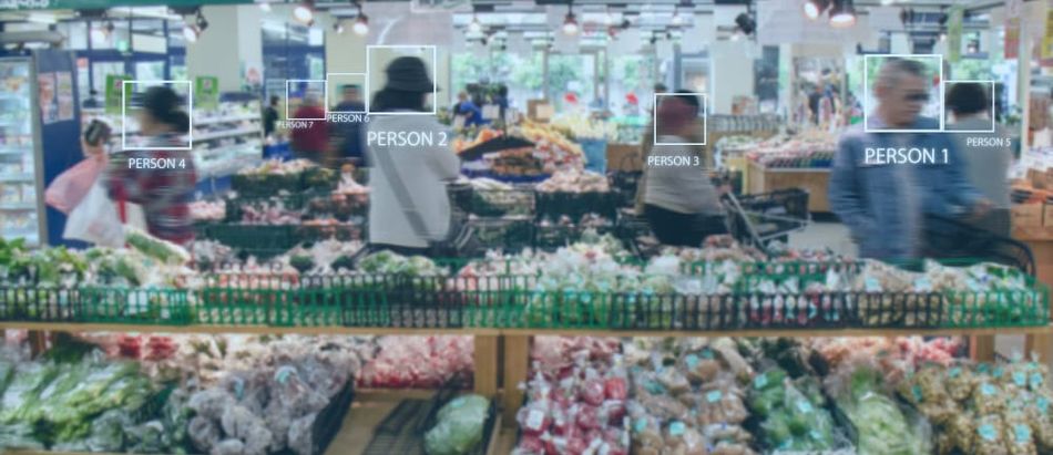
Data association refers to analyzing which readings from different sensors belong to the same object or event in the real world.[6] Otherwise, the combined data can’t be trusted to match the real-world conditions. Eventually, it impacts decision-making in autonomous systems.
A common data association method is to match raw geometric data. For example, a mobile robot with a camera and lidar can match edges or corners seen in the image with points in the lidar point cloud. Once it knows which features go with which points, it can fuse the two into a more accurate picture of its surroundings.[2]
Data association also matters when tracking several targets at once, like in air traffic control or surveillance. Radar and cameras may follow many objects together, and algorithms such as Joint Probabilistic Data Association (JPDA) decide which measurement belongs to which target. That way, the system keeps an up-to-date track of each one.[6]
Suggested Reading: Autonomous safety with radar, not LiDAR
State Estimation
State estimation is about working out the true state of a system from the sensor data you have. It matters because real sensors are noisy and often leave gaps. So, a good estimate still gives you a reliable picture of the environment.[6]
The Kalman filter is the most widely used method. It works in a loop. It uses a mathematical model to predict the current state, then corrects that prediction when new sensor data comes in. This suits sensor fusion well because it copes with the noise and uncertainty in real sensor data.[7]
A self-driving car is a good example. It can use a Kalman filter to estimate its position and speed from GPS, inertial sensors (IMUs), and wheel encoders. Every new reading updates the estimate, so the car always knows where it is and how fast it is moving. Safe navigation depends on that.[8]
Suggested Reading: The Future of GPS: Innovations and Impacts on Navigation
Sensor Calibration
Sensor calibration is critical in sensor fusion because it ensures sensor data consistency.[3] It makes sure that raw data from sensors is trustworthy. Calibration involves adjusting the sensor measurements to account for various factors, such as sensor biases, scale factors, and misalignments, which can affect the accuracy and reliability of the data.
Different sensors may have different characteristics, and their measurements may not be directly comparable without appropriate adjustments. For instance, a camera and a lidar sensor may have different resolutions, fields of view, and coordinate systems, and their data may need to be transformed or scaled before it can be combined effectively.
There are various techniques for sensor calibration[2], ranging from measuring known reference objects to more complex configurations that involve optimization algorithms or machine learning. The choice of calibration method depends on the sensor type, desired accuracy, and complexity of the sensor fusion system.
Sensor Fusion Techniques
There are several sensor fusion techniques that vary in terms of complexity, computational requirements, and accuracy. This section will discuss three main categories of sensor fusion techniques:
Centralized fusion
Distributed fusion
Hybrid fusion.
Centralized Fusion
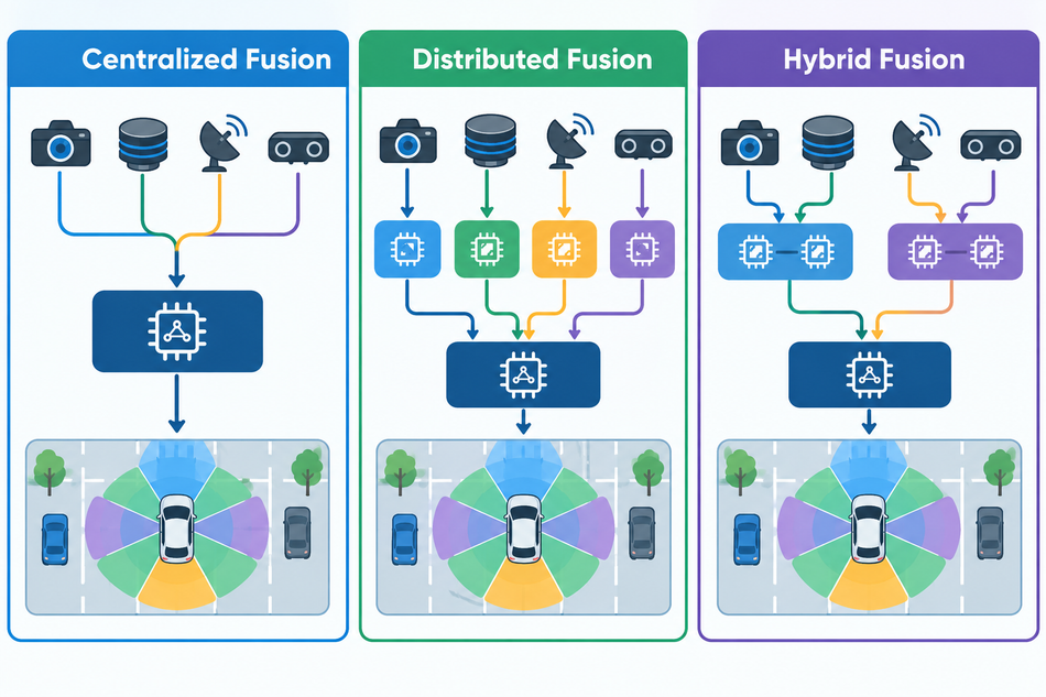
Centralized fusion is a technique where all sensor data is sent to a central processing unit or computer. The computer combines the data and performs the necessary computations to generate an overall estimate of the system's state.
In applications like autonomous vehicles or robotics, centralized fusion can be an effective approach. It enables the system to make decisions based on a comprehensive view of the environment.
For example, a self-driving car equipped with cameras, lidar, radar, and ultrasonic sensors can send all sensor data to a central computer, which then processes the data and determines the vehicle's position, velocity, and surrounding obstacles.
Key Advantages
A single point of access
Accurate and precise measurement
Reduced redundancy
No overlapping during data collection
Reduced cost of implementation
Low maintenance
Kalman filter[7] is a widely used centralized fusion technique. It can be applied to a centralized fusion system by processing the data from all sensors within the central processing unit and updating the system's state estimate accordingly.
At the same time, centralized fusion can create processing bottlenecks and a single point of failure. In time-critical applications like autonomous driving, centralized processing may delay decisions. Moreover, it is less suitable for large-scale, distributed systems due to communication delays, bandwidth limitations, node failures, and frequent changes in network nodes.
Distributed Fusion
Distributed fusion overcomes many limitations of centralized fusion. It improves robustness, scalability, privacy, and latency. This technique features multiple processing nodes, which independently process subsets of sensor data, then combine their estimates to determine the overall system state. This reduces communication overhead, processing bottlenecks, and single points of failure.[9]
For example, in smart city monitoring, distributed fusion techniques such as the Centralized/Decentralized Kalman Filter (CDKF) enable local processing across thousands of sensors, reducing communication delays and improving system performance.
Key Advantages
More robust and resistant to failures
Easy to handle bulk data with additional nodes
Flexibility to add/remove nodes at ease
Lowering risks of data breach with local data processing
Reduced system latency and improved performance
There are different distributed fusion techniques:
Consensus-based fusion: different nodes in the network communicate with each other to reach a consensus on the final output
Decentralized Kalman filtering: each node performs a local Kalman filter on its own measurements, and then exchanges filtered estimates with its neighbors
Particle filtering: each node maintains a set of particles that represent possible system states and are updated using measurements received from other nodes
Multi-hypothesis tracking: each node maintains multiple hypotheses about the state of the system, based on its own measurements and measurements received from other nodes
Decentralized Bayesian networks: nodes exchange messages with their neighbors to update their local networks, and use the updated networks to calculate a final output
However, in dynamic environments, where the distribution of sensors and data sources can change rapidly, a purely decentralized approach may not be able to keep up. Distributed fusion also finds its limitations in high-level decision-making and in applications where the consequences of errors or failures are severe.
Hybrid Fusion
Hybrid fusion is a sensor fusion technique that combines elements of both centralized and distributed fusion.[9] In this approach, multiple levels of data fusion are employed, with some processing occurring locally at the sensor level or within sensor clusters, and higher-level fusion taking place at a central processing unit. This hierarchical structure offers scalability and robustness of distributed fusion while still allowing for centralized decision-making and coordination.
For instance, a hybrid fusion architecture could be implemented in an autonomous vehicle equipped with multiple sensor types, such as cameras, lidar, and radar. The data from each sensor type could be processed locally, generating intermediate estimates of the vehicle's state and environment. These intermediate estimates could then be sent to a central processing unit, which would combine them to generate the final, overall state estimate.
Hybrid fusion is particularly well-suited for applications that require both local decision-making and global coordination. In the case of a swarm of autonomous drones, for example, each drone could use local sensor data to make decisions about its immediate environment and actions, while the central processing unit could coordinate the overall mission objectives and ensure that the swarm operates as a cohesive unit.
Key Advantages
High accuracy and precision for a complex sensor system
Easy to handle dynamic environments, where the distribution of sensors and data sources can change rapidly
High reliability over decentralized local data processing for critical applications
Easy to offload computational burden in resource-constrained systems
Sensor Fusion Levels
Centralized, distributed, and hybrid fusion describe where the fusion runs. Fusion levels describe what gets fused: raw data, extracted features, or decisions. Fusion processes are often categorized in a three-level model that distinguishes low-level, intermediate-level, and high-level fusion.[1]
Low-level sensor fusion (data-level or raw data fusion) combines several sources of raw data to produce new data that is expected to be more informative than the inputs.[1] Castanedo describes the raw data being provided directly as input to the fusion process, which provides more accurate data, with a lower signal-to-noise ratio, than the individual sources.[6]
Mid-level fusion (intermediate-level or feature-level fusion) combines features such as edges, corners, lines, textures, or positions into a feature map that may then be used for segmentation and detection.[1]
High-level sensor fusion (decision-level fusion) combines decisions from several experts. Elmenreich lists voting, fuzzy logic, and statistical methods as decision fusion methods,[1] and Castanedo notes that Bayesian methods are typically employed at this level.[6]
Dasarathy refined this three-level model into five categories based on the abstraction level of each process's input and output data, from data in, data out (DAI-DAO) to decision in, decision out (DEI-DEO).[1][6]
Level | What is fused | Strengths | Weaknesses |
Low-level (data-level, early fusion) | Raw or pre-processed sensor data[1][10] | Retains all information;[2] a neural network learns the joint features of the modalities at an early stage[10] | Requires precise extrinsic and temporal calibration of the sensors;[2] sensitive to misalignment caused by calibration error, different sampling rates and sensor defects[10] |
Mid-level (feature-level, middle fusion) | Features such as edges, corners, lines, textures or positions;[1] feature representations at intermediate network layers[10] | Lets a network learn across modalities with different feature representations and at different depths[10] | Not easy to find the optimal way to fuse intermediate layers[10] |
High-level (decision-level, late fusion) | Decisions from each sensor's own processing chain[1][10] | Modular: a new sensor needs only its own network trained;[10] lower relative complexity than low- or mid-level fusion[2] | Discards rich intermediate features;[10] lower-confidence classifications can be discarded, for example when obstacles overlap[2] |
Early vs Late Fusion
In deep learning, the choice of level becomes a question of when to fuse: Feng et al. describe combining sensing modalities at early, middle, or late stages of a neural network.[10]
Early fusion fuses the raw or pre-processed sensor data. It fully exploits the raw data and has low computation and memory requirements, but it is inflexible: when a sensing modality is replaced, the network needs to be retrained completely.[10]
Middle fusion combines the feature representations from different sensing modalities at intermediate layers, as a compromise between early and late fusion.[10]
Late fusion combines the decision outputs of separate networks, one for each sensing modality. It is flexible and modular, but it costs more computation and memory and discards intermediate features.[10]
Feng et al. found no conclusive evidence in the methods they reviewed that one fusion method is better than the others. Performance is highly dependent on the sensing modalities, the data, and the network architecture.[10]
Sensor Fusion Algorithms
Sensor fusion algorithms are mathematical techniques that combine data from multiple sensors to provide a more accurate and reliable estimate of the state of a system or environment.
Kalman Filter
The Kalman filter is a widely used and well-established sensor fusion algorithm that provides an optimal estimate of the state of a linear dynamic system based on noisy and uncertain measurements. Developed by Rudolf E. Kálmán in the 1960s, the Kalman filter has been applied to a wide range of applications, including navigation, robotics, and finance.[7]
The algorithm consists of two main steps: prediction and update.
In the prediction step, the filter uses a linear model of the system dynamics to predict the state at the next time step, incorporating process noise to account for uncertainties in the model.
In the update step, the filter combines the predicted state with the latest measurement, weighted by their respective uncertainties, to produce a refined state estimate.
One of the key advantages of the Kalman filter is its ability to provide an optimal estimate under certain conditions. Specifically, the filter is optimal when the system dynamics and measurement models are linear, and the process and measurement noise are Gaussian distributed. For instance, position tracking of an object in two-dimensional space using a radar or a GPS.
Moreover, the Kalman filter is computationally efficient, making it suitable for real-time applications and systems with limited computational resources (e.g., robot localization and mapping, and autonomous vehicles).
To illustrate the application of the Kalman filter, consider an autonomous vehicle trying to estimate its position using GPS measurements. GPS measurements are typically subject to various sources of noise, such as atmospheric effects and multipath interference. By applying the Kalman filter, the vehicle can combine the noisy GPS measurements (Kalman Update) with its internal model of motion (Kalman Prediction), resulting in a more accurate and reliable estimate of its position.
However, the Kalman filter comes with certain limitations as well. If the models or noise are nonlinear or non-Gaussian, the Kalman filter may not provide accurate estimates. It does not consider long-term trends or history, which can lead to suboptimal estimates in some cases. Also, it requires a significant amount of computational resources, especially when dealing with high-dimensional systems or complex models.
Extended Kalman Filter (EKF)
The standard Kalman filter estimates a process governed by a linear stochastic difference equation. When the process or the measurement relationship is nonlinear, the extended Kalman filter is used.[7] It linearizes the estimation around the current estimate using the partial derivatives, collected in Jacobian matrices, of the process and measurement functions.[7]
The EKF is one of the most often employed methods for fusing data in robotic applications,[6] and EKF-based approaches were among the main probabilistic formulations of simultaneous localization and mapping (SLAM) in its classical age, from 1986 to 2004.[12] Its weaknesses are well documented:
After the nonlinear transformations, the distributions of the random variables are no longer normal, and Welch and Bishop describe the EKF as "an ad hoc state estimator that only approximates the optimality of Bayes' rule by linearization".[7]
Its first-order accuracy is inadequate for highly nonlinear systems, and it needs explicit derivative matrices, which rules it out for discontinuous or other non-differentiable systems.[11]
Computing the Jacobians is expensive.[6] Fang et al. add that the need for derivatives, together with a computational complexity of O(n³) in the state dimension n, limits the EKF to low-dimensional systems.[11]
Recommended Reading: Lidar SLAM: How It Works, Key Algorithms, and How to Implement It
Unscented Kalman Filter (UKF)
The unscented Kalman filter (UKF), avoids the linearization step.[6][11] It is based on the unscented transform, where the random variable is approximately represented by a set of sample points, called sigma points, chosen deterministically to capture its mean and covariance. The sigma points are propagated through the nonlinear function, and the new set is used to form the mean and covariance of the transformed variable.[11]
Compared with the EKF, the UKF has a computational cost of the same order, O(n³), but offers second-order accuracy, and its operations are derivative-free, so no Jacobians need to be calculated.[11] It can also be employed in parallel implementations.[6]
Its limit is scale: with 2n + 1 sigma points, the UKF faces substantial computational expense when the system is high-dimensional.[11]
Particle Filter
The particle filter, also known as the Sequential Monte Carlo (SMC) method, is a powerful sensor fusion algorithm used for estimating the state of non-linear and non-Gaussian systems. Unlike the Kalman filter, the particle filter does not rely on linear assumptions and can handle complex, non-linear dynamics and measurement models.
The particle filter operates by representing the state probability distribution using a set of weighted particles. Each particle represents a possible state of the system, with its weight reflecting the likelihood of that state given the available measurements. The algorithm consists of three main steps: sampling, weighting, and resampling.
Sampling: In this step, a new set of particles is generated by sampling from the current state probability distribution, typically using a proposal distribution that approximates the true distribution. This proposal distribution can be based on the system's dynamics or a combination of the dynamics and the latest measurement.
Weighting: The weights of the particles are then updated based on their compatibility with the latest measurement. Particles that are more consistent with the measurement receive higher weights, while those that are less consistent receive lower weights.
Resampling: Finally, a new set of particles is generated by resampling from the current set, with the probability of selecting each particle proportional to its weight. This resampling step ensures that particles with low weights are replaced by more likely particles, focusing the representation of the state distribution on the most probable regions. For example, if there are 100 particles, and 10 particles have significantly higher weights than the others, the resampling step will generate a new set of particles with a higher proportion of the 10 high-weight particles.
In summary, the sampling step generates a set of particles, the weighting step assigns weights to the particles based on their consistency with the measurement, and the resampling step generates a new set of particles based on their weights. By iterating through these steps, the particle filter can estimate the posterior distribution of the system state in a nonlinear and non-Gaussian system.
Recommended reading: Difference between active and passive filters?
Bayesian Networks
Bayesian networks are a powerful tool for representing and reasoning with probabilistic relationships between variables in a system.
In the context of sensor fusion, Bayesian networks can be used to model the relationships between sensor measurements, the underlying system state, and any other relevant variables, such as environmental conditions or sensor calibration parameters.
A practical example of using Bayesian networks for sensor fusion is in the field of environmental monitoring. Suppose an air quality monitoring system consists of multiple sensors measuring pollutants, temperature, and humidity. A Bayesian network can be used to model the relationships between these measurements and the underlying air quality index.
One of the key advantages of Bayesian networks is their ability to handle incomplete or uncertain information. When sensor data is missing, noisy, or otherwise uncertain, the network can still provide meaningful estimates of the system state by propagating the available information through the network's probabilistic relationships.
For instance, by fusing data from all the sensors, the network can provide a more accurate and reliable estimate of the air quality index, even if some of the sensors are noisy or malfunctioning.
This makes Bayesian networks a valuable tool for sensor fusion applications, where the quality of sensor data can often be compromised by factors such as sensor failures, environmental noise, or occlusions.
Bayesian networks are a powerful tool for sensor fusion, but they have some limitations that can impact their effectiveness in certain situations. These limitations include model difficulty in high-dimensional systems, inaccuracy for nonlinear and non-Gaussian models, and inaccurate estimates under limited data.
Complementary Filter
Mahony, Hamel and Pflimlin apply complementary filtering to attitude estimation: estimating orientation from the measurements of typical low-cost inertial measurement units (IMUs), whose outputs are characterized by high noise levels and time-varying additive biases.[13]
Their explicit complementary filter requires only accelerometer and gyro outputs, is suitable for implementation on embedded hardware, and provides good attitude estimates while estimating the gyro biases online. They demonstrated it on a robotic test-bed and a radio-controlled unmanned aerial vehicle.[13]
Learning-Based Sensor Fusion
Deep learning adds fusion methods in which a neural network learns how to combine the sensors. In autonomous driving, cameras, lidars, and radars can be fused to exploit their complementary properties, but Feng et al. note that there is no general guideline for network architecture design: what to fuse, when to fuse, and how to fuse remain open questions.[10]
BEVFusion, presented at ICRA 2023, is one example. At the time, recent approaches were based on point-level fusion, augmenting the lidar point cloud with camera features. BEVFusion instead unifies camera and lidar features in a shared bird's-eye view (BEV) representation, which preserves both geometric and semantic information. On the nuScenes benchmark, its authors report 1.3% higher mAP and NDS for 3D object detection and 13.6% higher mIoU for BEV map segmentation, with 1.9x lower computation cost.[14]
Comparing Sensor Fusion Algorithms
The table summarizes the main assumptions, computational cost, and typical uses of each algorithm. A filter's performance can be problem-dependent, so Fang et al. suggest trying different filters where possible to find the one that performs best for a specific problem.[11]
Algorithm | Main assumptions | Computational cost | Typical use |
Kalman filter | Linear process; independent, white, normally distributed noise[7] | Efficient recursive computation[7] | Autonomous or assisted navigation[7] |
Extended Kalman filter | Nonlinear but differentiable models, linearized around the current estimate[7][11] | O(n³); Jacobians needed; suited to low-dimensional systems[11] | Guidance and navigation, target tracking, robotics including SLAM, sensor fusion[11] |
Unscented Kalman filter | Nonlinear models; no derivatives needed[11] | Same order as the EKF, O(n³), with 2n + 1 sigma points; low- to medium-dimensional systems[11] | The same application areas as the EKF[11] |
Particle filter | Nonlinear dependencies and non-Gaussian densities in the model and the noise[6] | O(Nₛn²) with many more particles Nₛ than state dimensions n;[11] a large number of particles is needed for a small estimator variance[6] | Nonlinear, non-Gaussian estimation; Rao-Blackwellized particle filters in SLAM[12] |
Bayesian methods | Evidence combined by probability rules; a priori probabilities must be established[6] | Grows with the number of potential hypotheses and dependent events[6] | Decision-level fusion[6] |
Explicit complementary filter (Mahony et al.) | Accelerometer and gyro inputs; gyro bias estimated online[13] | Suitable for embedded hardware[13] | Attitude estimation with low-cost IMUs, for example on UAVs[13] |
Learning-based fusion | Learned from data; no general guideline for the network architecture[10] | Depends on the network; early fusion needs less computation and memory than late fusion[10] | Object detection and semantic segmentation in autonomous driving[10] |
Applications of Sensor Fusion
Sensor fusion has a wide range of applications across various domains. However, let’s discuss the three most popular domains.
Robotics
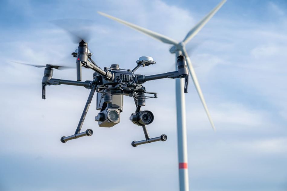
Sensor fusion enables robots to perform localization, mapping, navigation, and object recognition by combining data from cameras, LIDAR, ultrasonic sensors, and IMUs. Drones exemplify this approach, integrating camera, IMU, GPS, and rangefinder data to estimate position, orientation, and velocity.
This enables stable flight, obstacle avoidance, and adaptation to dynamic environments, supporting tasks such as aerial photography and payload delivery while improving navigation accuracy, reliability, and overall performance.
Another strong example would be the industrial automation sector, where sensor fusion is used to enhance the performance of robotic manipulators and assembly systems. By integrating data from force sensors, cameras, and other sensing modalities, these systems can achieve higher precision and accuracy in tasks such as object grasping, part alignment, and assembly.
This improved performance ultimately leads to increased productivity and reduced manufacturing costs.
Autonomous Vehicles
In order to safely and efficiently navigate complex traffic environments, self-driving vehicles must rely on a wide variety of sensors to gather information about their surroundings.
For example, cameras can provide detailed visual information about road signs, traffic lights, and other vehicles, while LIDAR and radar can offer precise distance and velocity measurements.
But they have limitations too. For instance, while cameras can capture high-resolution color images, they may struggle in low-light conditions or with glare from the sun. On the other hand, LIDAR is unaffected by lighting conditions but provides lower-resolution, distance-based data. But by combining these two data sources, an autonomous vehicle can more reliably detect and identify objects such as pedestrians, cyclists, and other vehicles, even in challenging conditions- allowing it to make informed decisions about acceleration, braking, and steering with ease.
Smart Cities
Smart cities utilize sensor fusion to aggregate data from a wide range of sources, including environmental sensors, traffic cameras, and mobile devices, to optimize various aspects of city life, such as traffic management, public safety, and energy consumption.
To illustrate this better, let’s take the example of a traffic management system in smart cities.
By combining data from cameras, vehicle sensors, and traffic signals, a smart traffic management system can analyze traffic patterns and optimize traffic signal timing to minimize congestion and reduce travel times. This can result in significant fuel savings and reduced emissions, contributing to a greener and more sustainable urban environment.
Smart cities can also use sensor fusion to optimize resource allocation and service delivery. For example, by fusing data from various environmental sensors, such as air quality monitors and weather stations, a city can better understand and predict patterns of air pollution, enabling targeted interventions to reduce emissions and protect public health.
Similarly, by integrating data from waste collection sensors and vehicle tracking systems, a city can optimize waste collection routes and schedules, reducing fuel consumption and improving overall efficiency.
Recommended reading: Smart City Internet of Things: Revolutionising Urban Living
Challenges and Limitations of Sensor Fusion
Despite many benefits, sensor fusion comes with some application challenges and limitations. Let’s discuss some common challenges for the industries leveraging this technology, such as healthcare and automotive.
Computational Complexity
One of the primary challenges associated with sensor fusion is the computational complexity involved in processing and integrating data from multiple sensors. As the number of sensors and the volume of data increases, the processing power and memory requirements for fusing this data also grow. This can lead to increased latency and reduced real-time performance, which may impact critical applications such as autonomous vehicles or robotics.
For instance, a LIDAR sensor can generate millions of data points per second, while high-resolution cameras can capture vast amounts of pixel information. Combining these data streams requires sophisticated algorithms that can quickly and accurately process, filter, and integrate the data, while also accounting for uncertainties and noise inherent in sensor measurements.
To address these challenges, researchers are developing more efficient algorithms and techniques for sensor fusion, including distributed and parallel processing approaches. By dividing the fusion process across multiple processors or even across different sensors, it may be possible to reduce the computational burden and improve overall performance.
Data Privacy and Security
Data privacy and security are essential concerns with sensor fusion systems. As multiple sensors collect and share a significant amount of data, the risk of unauthorized access or data breaches increases. Such breaches can result in the loss of sensitive information and violation of individual privacy.
One challenge in securing sensor fusion systems is the need to protect data both in transit and at rest. Ensuring the integrity of data exchanged between sensors and fusion systems requires secure communication protocols and encryption mechanisms.
For example, Transport Layer Security (TLS) can be employed to protect data transmitted over networks, while symmetric encryption algorithms, such as Advanced Encryption Standard (AES), can secure stored data.
Another challenge is the potential for malicious actors to tamper with or spoof sensor data, which can lead to incorrect or misleading fusion results. Countermeasures against such attacks include sensor data authentication and integrity checks, such as digital signatures or cryptographic hashes.
Sensor Compatibility
Sensor compatibility is a crucial factor when integrating multiple sensors into a fusion system. Different sensors may have different specifications, data formats, and communication protocols, which can make it challenging to combine and process their data effectively. These disparities can result in data misalignment, increased complexity, and reduced overall system performance.
One approach to addressing sensor compatibility issues is the use of standardized data formats and communication protocols. By adhering to common standards, such as the SensorML standard for sensor data description or the IEEE 1451 family of standards for smart sensor integration, it becomes easier to incorporate and manage diverse sensors in a fusion system.
Moreover, sensor fusion algorithms must be designed to handle the inherent differences between sensors, such as varying measurement units, resolutions, or sampling rates. Techniques like data interpolation, resampling, or normalization can be employed to bring sensor data to a common representation, enabling accurate and efficient fusion.
Conclusion
Sensor fusion has emerged as a powerful approach for combining data from multiple sensors to enhance the overall perception, reliability, and decision-making capabilities of various systems. By leveraging diverse sensor information, sensor fusion can overcome individual sensor limitations, reduce uncertainty, and increase the accuracy of the resulting data.
However, implementing sensor fusion systems is not without challenges. Addressing computational complexity, data privacy and security, and sensor compatibility are essential to ensure the effectiveness and robustness of these systems.
Frequently Asked Questions (FAQs)
1. What is the difference between sensor fusion and data fusion?
A: The terms overlap, and the literature does not use them consistently. Wald proposes data fusion as the overall term, while in some fusion models multidata fusion means the fusion of raw data only. Sensor fusion covers direct fusion of sensor data, while information fusion also takes in indirect sources such as a priori knowledge about the environment and human input.
2. What are the levels of sensor fusion?
A: Sensor fusion is often categorized in a three-level model: low-level or raw data fusion, intermediate-level or feature-level fusion, and high-level fusion, also called decision fusion. Dasarathy refined this into five categories based on the abstraction level of each process's input and output data. The JDL model, proposed in 1985 under the guidance of the US Department of Defense, uses a different scheme with five levels.
3. Is sensor fusion a form of machine learning?
A: Sensor fusion itself is not a form of machine learning, but machine learning techniques can be used in conjunction with sensor fusion to enhance its capabilities, improve accuracy, and enable intelligent decision-making based on the fused sensor data.
4. What is high-level sensor fusion?
A: High-level sensor fusion refers to the fusion of information or data obtained from multiple sensors at a higher level of abstraction, typically beyond the raw sensor data. High-level fusion, also called decision fusion, combines decisions from several experts rather than directly merging the raw sensor data. Examples of high-level sensor fusion can be found in various applications such as object recognition, situation assessment, and environmental monitoring.
5. What is the difference between early and late sensor fusion?
A: The main difference between early and late sensor fusion lies in the timing of data fusion. Early fusion combines raw or pre-processed sensor data, while late fusion combines the decision outputs of separate networks, one for each sensing modality. Early fusion fully exploits the raw data but is sensitive to misalignment between sensors; late fusion is modular, so a new sensor needs only its own network trained, but it discards rich intermediate features.
6. How does sensor fusion apply to accelerometers and gyroscopes?
A: Sensor fusion can be applied to accelerometer and gyroscope data to improve the accuracy of motion tracking and orientation estimation. Accelerometers measure linear acceleration, while gyroscopes measure angular velocity. By fusing data from both sensors, it's possible to obtain more accurate information about the orientation and movement of an object.
References
Sensor Fusion in Time-Triggered Systems, Wilfried Elmenreich, PhD dissertation, Vienna University of Technology, 2002.
Sensor and Sensor Fusion Technology in Autonomous Vehicles: A Review, Yeong, Velasco-Hernandez, Barry and Walsh, Sensors 21(6):2140, 2021.
A Semantic World Model for Urban Search and Rescue Based on Heterogeneous Sensors, Meyer et al., RoboCup 2010: Robot Soccer World Cup XIV, 2010.
A Review of Data Fusion Techniques, Federico Castanedo, The Scientific World Journal, 2013.
An Introduction to the Kalman Filter, Greg Welch and Gary Bishop, University of North Carolina at Chapel Hill, TR 95-041, updated March 1, 2004 (copy hosted by the University of Texas at Austin).
Improved vehicle navigation using sensor fusion of inertial, odometric sensors with global positioning system, N. Allan Anbu, Arun Kumar Pinagapani, Geetha Mani and K. R. Chandran, International Journal of Vehicle Autonomous Systems 15(3/4), 2020.
https://www.avnet.com/apac/resources/article/what-is-sensor-fusion/
Deep Multi-modal Object Detection and Semantic Segmentation for Autonomous Driving: Datasets, Methods, and Challenges, Di Feng et al., arXiv, 2019, revised 2020 (published version DOI 10.1109/TITS.2020.2972974).
Nonlinear Bayesian Estimation: From Kalman Filtering to a Broader Horizon, Huazhen Fang, Ning Tian, Yebin Wang, MengChu Zhou and Mulugeta A. Haile, arXiv, 2017.
Past, Present, and Future of Simultaneous Localization And Mapping: Towards the Robust-Perception Age, C. Cadena et al., IEEE Transactions on Robotics 32(6), 2016.
Nonlinear Complementary Filters on the Special Orthogonal Group, R. Mahony, Tarek Hamel and Jean-Michel Pflimlin, IEEE Transactions on Automatic Control 53(5), 2008.
BEVFusion: Multi-Task Multi-Sensor Fusion with Unified Bird’s-Eye View Representation, Zhijian Liu et al., ICRA 2023 (arXiv).
in this article
1. What is Sensor Fusion?2. Why Sensor Fusion is Important3. Key Principles of Sensor Fusion4. Sensor Fusion Techniques5. Sensor Fusion Levels6. Sensor Fusion Algorithms7. Applications of Sensor Fusion8. Challenges and Limitations of Sensor Fusion9. Conclusion10. Frequently Asked Questions (FAQs)11. References