Artificial Intelligence in Drone Technology
Unmanned Aerial Vehicles, UAVs, are becoming more and more available as technology becomes cheaper. This is an article about Drones which work on the principle of Artificial Intelligence.

15 Sep, 2021. 9 minutes read
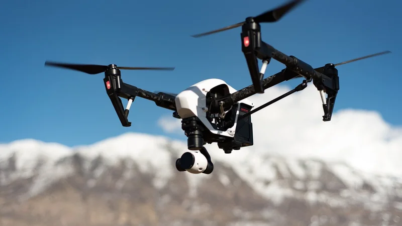
Quadcopter
In 2014, two planes had gone missing with no luck at finding the wreckage. Lives were lost and families are left wondering “what happened?”. In the world of truly autonomous vehicles, UAVs should react on their own through some sort of external stimuli. It is through these external stimuli that the UAVs react and adjust their goal accordingly. These stimuli can be taken from various sensors on the craft but also can be given commands by a human.
Drones are unmanned, aerial devices used for a variety of purposes. When first developed, these devices were manually, remotely controlled. Now, however, drones often incorporate artificial intelligence, automating some or all operations. The incorporation of AI enables drone vendors to use data from sensors attached to the drone to collect and implement visual and environmental data.
This data enables autonomous or assisted flight, making operation easier, and increasing accessibility. As a result, drones have become part of the smart mobility offerings that are now commercially available to businesses and consumers. AI-based drones rely largely on computer vision. This technology enables drones to detect objects while flying and allows the analysis and recording of information on the ground.
Computer vision works through high-performance, onboard image processing performed with a neural network. A neural network is a layered architecture that is used to implement algorithms in machine learning. Neural networks enable drones to perform object detection, classification, and tracking. This information is combined in real-time to enable drones to avoid collisions and locate and track targets.
To implement neural networks in drones, researchers must first train the machine learning algorithms to recognize and correctly classify objects in a wide variety of contexts. This is done by feeding specially marked images into the algorithm.
These images teach the neural network which traits classes of objects have and how to differentiate one type of object from another. More advanced neural networks continue learning without supervision during operation, improving detection and analysis with use.
Drones have three main applications.
SURVEILLANCE
Drones can be equipped with various types of surveillance equipment that can collect HD video and still images day and night. Drones can be equipped with technology allowing them to intercept cell phone calls, determine GPS locations, and gather license plate information. The high payload compatibility allows the use of different surveying systems such as lidar scanners, multi- and hyperspectral devices and much more – around the clock, with low staffing requirements and low costs.
Drone surveillance is the use of unmanned aerial vehicles (UAV) to capture of still images and video to gather information about specific targets, which might be individuals, groups or environments. Drone surveillance enables surreptitiously gathering information about a target as captured from a distance or altitude. Drone surveillance enables the surreptitious gathering of information about a target as captured from a distance or altitude.
Of course, drone use in this wide-ranging industry (or area) extends well beyond these fundamental and simplistic boundaries. The government officials, police and other security personnel use this drone technology. Automated surveillance is going to become increasingly common as companies and researchers find new ways to use machine learning to analyze live video footage.
A new project from scientists in the UK and India shows one possible use for this technology: identifying violent behavior in crowds with the help of camera-equipped drones. It uses a simple Parrot AR quadcopter to transmit video footage over a mobile internet connection for real-time analysis. An algorithm trained using deep learning estimates the poses of humans in the video and matches them to postures the researchers have designated as “violent.” For the purposes of the project, just five poses are included: strangling, punching, kicking, shooting, and stabbing.
However, the research needs to be taken with a pinch of salt, particularly with regard to its claims of accuracy. Some report that their system was 94 percent accurate at identifying “violent” poses, but they note that the more people that appear in frame, the lower this figure. (It fell to 79 percent accuracy when looking at 10 individuals.)
More importantly, though, these figures don’t represent real-world usage. In order to train and test their AI, the researchers recorded their own video clips of volunteers pretending to attack one another. The volunteers are generously spaced apart and attack one another with exaggerated movements. They acknowledged that this isn’t a perfect reflection of how the surveillance system might perform in the wild, but he said he has plans to test the drones during two upcoming festivals in India: Technozion and Spring Spree, both of which take place at NIT Warangal.
But even if this particular system has not yet proved itself in the wild, it’s a clear illustration of the direction contemporary research is going. Using AI to identify body poses is a common problem, with big tech companies like Facebook publishing significant research on the topic. And with the rise of cheap drones and fast mobile internet, it’s easier than ever to capture and transmit live video footage. Putting these pieces together to create sophisticated surveillance isn’t hard.
WEATHER FORECAST
The climate is changing. So is the face of natural catastrophes. Admittedly, drones fall short in matching the efficacy of satellite imagery in forecasting adverse weather events. However, when disaster does strike, they are capable of providing valuable assistance. Government authorities as well as insurers are waking up to the potential of using them to assess post-disaster damages, especially at sites not marked safe for humans to enter.
Using drones to collect atmospheric samples is a huge advance on traditional methods of data collection, and has the potential to vastly improve the accuracy of weather forecasting models. Why does it matter? Having more accurate models affects both the day-to-day and the big picture. It allows meteorologists to give us better 10 day weather forecasts, but more than that, it means the ability to give more advanced warning for storms such as tornadoes, or whether and where hurricanes will land.
The lowest layer of the atmosphere, called the boundary layer, is where most of our weather is happening. The weather conditions that impact each and every one of us are dependent on a dizzying number of variables and factors. Trying to make accurate predictions about what the weather will do next relies on very complicated weather forecasting models, but the output of these models is only as good as the data fed into them. And getting good data is harder than you might think. That’s where weather drones come in. Weather drones can be flown through the entire vertical layer of the boundary layer of the atmosphere, and collect crucial data on temperature, moisture, air pressure and wind speed and direction.Weather drones can collect this data in several ways.
One way is through temperature, humidity and air pressure sensors affixed directly onto the drone. Another way they collect data is by dropping sensors called dropsondes, fitted with a parachute, from a high altitude. The dropsondes descend through the vertical profile of the boundary layer, collecting data all the way down. One final important way weather drones collect data is through visual imaging, including photographs and video.
There are several important projects ongoing that are working to make use of and improve drones for weather data collection. One of these is directly connected to scientists working with the NOAA. They are working on short term field studies focused on s pecific regions of the US to study how terrain and land surface features affect weather patterns. The goal is to determine whether and how the land surface impacts weather, and how to incorporate that variable into weather and climate models.
More data from all over the nation (and the world), from more levels of the boundary layer, means more accurate weather forecasting models. Measurements from storm drones can help scientists evaluate current weather models, and identify and correct forecast models. Collaboration between scientists working on these data collection projects and local weather service forecast models is resulting in more accurate weather forecasts for local weather reporting. It’s a standing joke that meteorologists get to be wrong all the time with no one holding them accountable, but that could change with more accurate models.
DELIVERY
There are several applications in which delivery drones are used.
Health care : Drones can be used to transport medicinal products such as blood products, vaccines, and other supplies such as pharmaceuticals and medical samples. During the COVID-19 pandemic, drones began making medical deliveries of personal protective equipment and COVID- 19 tests in the United States and in Israel. Zipline has made more than 70,000 medical deliveries by drone as of October 2020.
By using drones to deliver blood donations, vaccinations, medications, anti-venom solutions, organ transplants, and other medical supplies, the medical segment of drone delivery is gaining quite a bit of traction. Between drone service providers and business-internal services, there are more than 30 companies using drones to deliver medical supplies. Integrated with Matternet’s autonomous M2 Drone and Cloud Platform, the new Matternet station supports the company’s vision of distributed, peer-to-peer drone logistics networks for urban environments, allowing hospitals and their supply partners to integrate automated drone delivery laboratories and pharmacy operations.
Food: Drones have been proposed as a solution for rapidly deliveringprepared foods, such as pizzas, tacos, and frozen beverages. Early prototypes of food delivery drones include the Tacocopter demonstration by Star Simpson, which was a taco delivery concept utilizing a smartphone app to order drone-delivered tacos in San Francisco area.
Initially drones have seen early adoption in Surveillance and Security, Mapping and Inspection and Detection industries because of the remote locations they have been easier to deploy there. Now drones do not only enhance the above industrial and commercial processes, delivery drones can also add a lot of value to logistical supply chains. Of late there has been a growing interest in the benefits that delivery drones can bring to commerce in general and the daily routines of people in particular, where the promise of having food delivered to you wherever you are, via a drone, is gaining traction.
Online Food Delivery (FD) platforms have taken off and represent a $350bn market today as these platforms are enticing consumers away from cooking or eating out to eating in the comfort of their own homes, or where ever they happen to be at a given moment. In the major markets of China, US, India, UK and Brazil, annual growth rates range from 5% to about 10% per annum. Worldwide online FD has become well accepted are clearly here to stay with many platforms having become household names.
Postal: Different postal companies from Australia, Switzerland, Germany, Singapore, the United Kingdom and Ukraine have undertaken various drone trials as they test the feasibility and profitability of unmanned delivery drone services. The USPS has been testing delivery systems with Horse-Fly Drones. When delivering parcels, drones often have a poorer energy balance than traditional delivery vans, as shown by a new study conducted at Martin Luther University Halle-Wittenberg.
In densely populated areas, drones consume comparatively high amounts of energy and their range is strongly influenced by wind conditions. In rural areas, however, they may be able to compete with diesel-powered delivery vans. The study has been published in the journal Transportation Research Part D: Transport and Environment. Wind conditions play a crucial role in how they perform. If there is a crosswind, for example, more energy must be expended to keep the drone on course.
On the other hand, headwinds or tailwinds can even have a slightly positive effect on energy consumption. "Drones consume a relatively large amount of energy when they have to hover in one place in the air, for example when they want to deliver a parcel and have to wait outside the door of the recipient's home," explains the economist.
Ship Resupply: The shipping line Maersk and the Port of Rotterdam have experimented with using drones to resupply offshore ships instead of sending smaller boats. Delivery drones are delivering supplies to marines in combat, allowing emergency food and ammunition deliveries in a short amount of time. The autonomous drones can carry 60 pounds of cargo and fly up to six miles away. The delivery drones are a part of the Tactical Resupply Unmanned Aircraft System’s (TRUAS) $225,000 competition.
PROGRAMMING ASPECT
Programming to build a drone is different from programming to make a drone perform some tasks. Building a drone involves interfacing sensors and actuators with some kind of processor to make the drone fly stably. But, to make an application all needed is a readily available drone and a computer where algorithms can be implemented.
If the question is about building a drone, I would say it depends on the hardware used to build it. For example, arduino if arduino based controllers are used. It is more of embedded systems. Communication between microcontoller and all other sensors is established so that the controller can process the sensor readings and sends control signals to actuators to achieve a stable flight.
Drones, in the nearest future, will be used to obtain privileged data which can be applied to weather forecasting, storm tracking, and precision agriculture. They can even be used for surveillance purposes, especially in search and rescue. We are right on track to a final destination where drones will eventually be self-sufficient.
REFERENCES -
1) Towards Automated Drone Surveillance in Railways: State-of-the- Art and Future Direction Conference Paper · October 2016 from book Content-Based Mammogram Retrieval Using Mixed Kernel PCA and Curvelet Transform (pp.336-348).
2)International Journal of Engineering Sciences and Research Technology Implementation of Voice Activated Autonomous QuadcopterPritesh A. Metha, M.E. (E&TC) & Prof. M. U. Inamdar Siddhant, College of Engineering, Pune
3)Surveillance and Security Management System Using Drone Ganeshwar.R, Ramprabhu.J, Manochitra.P, Kaliappan.S, Department of EEE, Kumaraguru College of Technology, Coimbatore